
Nor-easter
/
Where: Melbourne, Yarra Valley, Yarra Ranges, Kinglake, Healesville, Warburton, Lilydale
Length: 187km OR 134km (two route options)
Difficulty: moderate/hard
Terrain: flat and hilly
Surface: sealed & well-made gravel. Can be done comfortably on a road bike, though some may prefer a gravel bike.
What: challenging climbs, fast descents, temperate rainforest, farmland, Yarra River, small towns, gourmet food & wine


THE RIDE
This varied and challenging ride has a little bit of everything: big hills, fast descents, gravel, bitumen, rail-trail, rainforest, farmland, gourmet food and wine, and small towns.
There are two alternate starting points for this ride. You can start at Flinders Street station and ride all the way out of the city on bike tracks. Or you can jump on the train and start on the outskirts of town at Hurstbridge.
If you decide to start from Flinders St, you will be riding about 50km along the Main Yarra Trail and the Diamond Creek Trail before you get onto the road. Allow a few hours because it's quite winding and slow, and if you haven't done it before, you will probably get lost a few times. This is because, whilst the trails are 'marked', there are many points where it's not obvious where to go. Don't be afraid to ask people—local knowledge is very helpful. Otherwise you could consult your device or this guide to cycling in Melbourne: Bike Paths and Rail Trails
Probably the most important turn to remember is where the Diamond Creek Trail branches off from the Main Yarra Trail, which happens at 37km, shortly after Westerfolds Park. There is a bridge across the river to the left at the bottom of a short gravel slope. Apart from this, just attempt to follow the signage for the various trails and allow plenty of time. Also worth noting is that the 5km of road between Diamond Creek and Hurstbridge is pretty busy and doesn't always have a good shoulder. Though having said all this, the ride out of the city is really quite pleasant, with riverside riding, lots of bushland and some nice places to stop for refreshments. (see map)
If you choose to start in Hurstbridge, things are much more straightforward. Take a left out of the station car-park and follow the signs to Kinglake. The 20km to Kinglake is on a fairly narrow and winding, though scenic road. You will ride into forested hills where the remnant burnt tree trunks of the Black Saturday fires are still visible. Generally the traffic is not too bad though it can get a bit busy on a nice weekend. Some confidence riding in traffic will help here. On this stretch you will also tackle the first major climb of the ride, a medium-sized uphill with a gentle gradient.
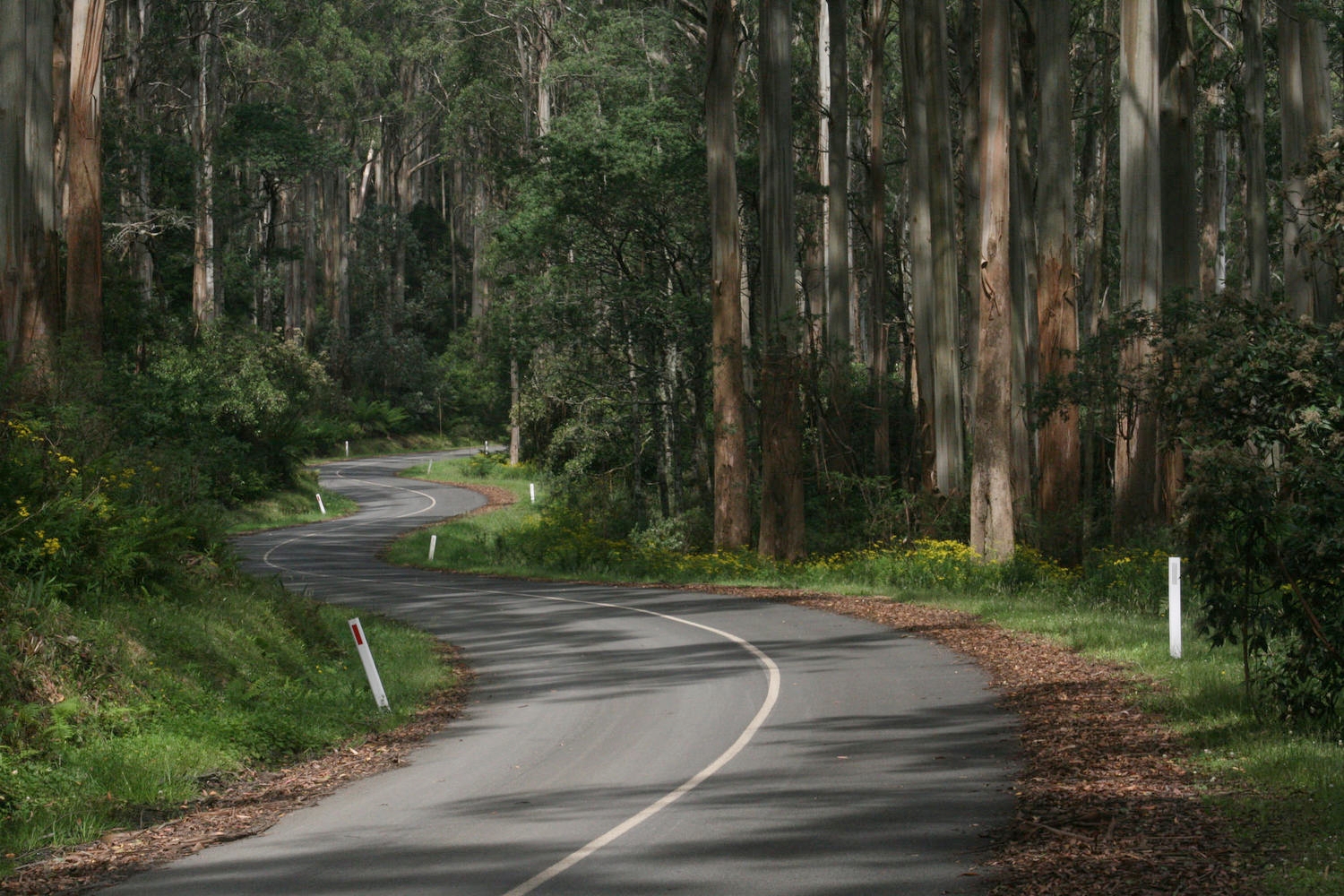
You can also expect a little traffic on the undulating road from Kinglake to Toolangi. This 15km section is very pretty, taking you through tall and lush eucalypt forest. Shortly after Toolangi take a left onto Myers Creek Road, which you'll follow to Healesville. This road is quiet and features a fun, narrow and twisty descent. On Myers Creek Road there are a few nice looking B&B style places, and a high tea place.
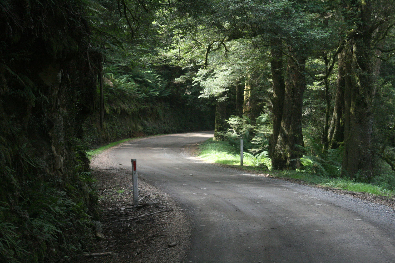
After Healesville the punishment begins, with a climb up Mt Donna Buang. This really is one of the cycling gems of Victoria. It's close to Melbourne, the road is quiet and very beautiful, and there are some fantastic views along the way. It's a big climb with some gravel and some steep sections, so settle in for the long haul. There are a couple of spots where you can often fill up your bottle from natural streams. The summit is a couple of km detour to the left once you get onto the main road. The descent on the other side is fully sealed, fast and a bucket of fun.
This descent will spit you out into Warburton, from where you will join the more sedate Lilydale-Warburton Rail Trail for the highly pleasant 40km trip to Lilydale. Another cycling gem, this trail meanders through the Yarrra Valley's lush farmland and bushland. There are some nice towns and cafes on this trail. Lilydale, the end point, is at the end of the metro train line which you can take you back to Flinders Street station.

Half of your donation goes directly to contributors for creating new ride guides just like this one (read more about how this works). The other half covers the costs of running the website, and what’s left is my wage for the work I put into it.
Note: the software I use to process donations insists on collecting email and postal addresses, and I can’t turn that off! I’m not interested in your personal information, so if you would rather keep that to yourself, just enter fake details.
ATTRACTIONS
Yarra Valley—known for its wineries, local produce, etc.
Mt Donna Buang summit—131km
Healesville Sanctuary—renowned wildlife sanctuary
Fairfield Boathouse—historic boathouse and a lovely place to stop for a coffee
Abbotsford Convent—historic convent, Lentil As Anything restaurant, Collingwood Childrens Farm and cafe
WHEN
Mt Donna Buang often sees snow in winter, so if you're going at that time, be prepared for that. Heat can be extreme in summer. Roads will be busier in peak holiday times.
GETTING THERE
Start and end points can be accessed via Melbourne's metro train network.
MAPS
Download GPX Track file of this route
Bike Paths and Rail Trails booklet—handy for the Yarra and Diamond Creek Trail
Yarra Valley attractions and accommodation
OTHER LINKS
OTHER RIDES LIKE THIS ONE


Disclaimer: should you choose to cycle this route, you do so at your own risk. Although all reasonable efforts have been made to ensure its accuracy at the time of writing, Adventure Cycling Victoria cannot guarantee that the information herein is 100% correct. The information published is meant as a guide only, and should be combined with your own due diligence and planning. Adventure Cycling Victoria and its contributors are in no way liable for personal injury, damage to personal property, or any other such situation that might happen to individuals following this route.

Where: Yarra Valley, Yarra Ranges, Lake Eildon, Goulburn Valley, Ruffy Highlands—Central Victoria
Length: 316km
Difficulty: moderate/hard
Terrain: some flat riding, some quite hilly riding. Most of the climbing is not terribly steep.
Surface: mostly well made gravel, some chunky gravel, some sealed roads. Can be done on a standard gravel bike.
What: pretty rural areas, temperate rainforest, rail trail riding, quiet back roads, lakeside riding, eucalyptus woodland.