
Goldfields Track
/
Where: Ballarat, Daylesford, Castlemaine, Bendigo—Central Victoria
Length: 202km
Difficulty: moderate/hard
Terrain: hilly
Surface: single track, vehicle tracks, gravel road, some sealed road. Mountain bike recommended.
What: great mountain-biking, gold mining history, historic towns, mineral springs, bushland, forest, farming land


THE RIDE
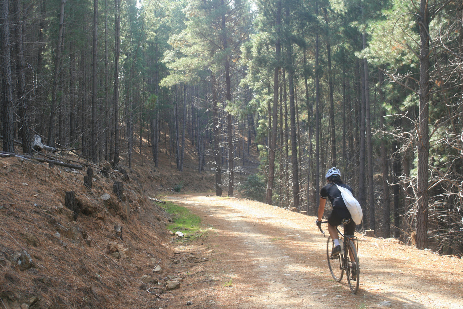
The Goldfields Track is Victoria's longest off-road cycling trail, and it's a beauty. It's divided into three roughly equal parts - the Wallaby Track, Dry Diggings Track and Leanganook Track - and will take you on a tour through the scene of the world's greatest ever gold rush, which occurred here during the 1850's. A lot of the riding is rough and/or somewhat technical, and you'll enjoy it most on a mountain bike, however the Leanganook track is the least technical section, and isn't too bad on a cyclocross or similar bike.
The track traverses a variety of landscapes, including dry eucalypt forest, farming land, pine plantations and pockets of rainforest, as well as a few well-serviced towns. You can also expect a variety of surface types and riding conditions, including a lot of single-track, vehicle tracks of various quality, and the occasional sealed road. There aren't any major climbs, but frequent and often steep undulations that together add up to a fair bit of up hill. If you are new to touring on a mountain bike, you'll probably be surprised at how slow your progress will be compared to on-road touring, so allow plenty of time.
The Goldfields Track is a marked trail, meaning that, in theory at least, you simply need to follow signposts to find you way. For much of the trail this is the case, but there are enough places where signposts are either missing or easy to overlook to make navigation a bit tricky. There are a lot of unmarked tracks meandering through the bush, so expect to spend a bit of time puzzling over directions. I would recommend taking paper maps and a GPS device or phone with a navigational function. Phone reception on the Telstra network seems to be pretty good generally, although there are likely some sections where you will not get coverage. See the 'maps' section below for more detail.
Navigational difficulties aside, it's a fantastic and varied ride, a rugged and interesting introduction to off-road bikepacking that never strays too far from civilisation.

Half of your donation goes directly to contributors for creating new ride guides just like this one (read more about how this works). The other half covers the costs of running the website, and what’s left is my wage for the work I put into it.
Note: the software I use to process donations insists on collecting email and postal addresses, and I can’t turn that off! I’m not interested in your personal information, so if you would rather keep that to yourself, just enter fake details.
ATTRACTIONS
History - you will pass many signs of the gold rush along the trail, including ruins and old diggings. Many of the towns en route also maintain a large part of their gold-rush-era charm, with grand old buildings still standing in the central districts. There is plenty to do and see in the towns as well.
Hepburn Springs - known for its abundance of natural mineral springs, there is plenty of opportunity to pamper yourself here.
There is a vibrant arts scene in this region, with plenty to see and festivals at various times of year. Visit artsatlas.com.au for more details.
ACCOMMODATION/CAMPING
I have marked all of the free or low-cost campsites on the map above, with a little info about each of them and links to relevant websites. Most don't need to be booked but some do.
Commercial accommodation of various quality is available in the towns en route - Ballarat, Creswick, Daylesford, Hepburn Springs and Bendigo. Just do some internet searching.
WHEN
This part of Victoria has something of a 'continental' climate - hot in summer and cold in winter - and not as much rain as further south. It can be ridden at any time of year, but be ready for the extremes of temperature in summer and winter.
GETTING THERE
V-line trains run roughly hourly to/from Bendigo and Ballarat, making this an easy ride to get to and from. Trains also stop in Castlemaine, and Daylesford is serviced by a V-line bus.
MAPS
Download GPX Track file for this route. I believe this is the only GPX file easily available on the web for the whole bike route of the Goldfields Track.
The Goldfields Track Walking and Cycling Guide is a booklet available for purchase on the Great Dividing Trail Association website or local visitor centres. It contains decent maps as well as a lot of interesting information on the history, biodiversity and geology of the area. I would recommend buying this booklet as I think it adds a great deal to the experience. Be aware that the maps in this book do not cover the bike diversion around Mt Alexander north of Castlemaine, however this section is pretty straightforward so it shouldn't be too difficult to find your way using other means.
Individual paper maps of each of the three sections of the Goldfields Track can be bought online from the Great Dividing Trail Association website, or from visitor centres in some of the towns en route (call ahead for availability). However I would not recommend these maps as they are not very detailed and you will likely struggle to navigate with them. In fact, it is stated on them that they are 'not designed to be used as navigational aids.' The maps in the Walking and Cycling Guide are much more detailed.
OTHER LINKS
OTHER RIDES LIKE THIS ONE


Disclaimer: should you choose to cycle this route, you do so at your own risk. Although all reasonable efforts have been made to ensure its accuracy at the time of writing, Adventure Cycling Victoria cannot guarantee that the information herein is 100% correct. The information published is meant as a guide only, and should be combined with your own due diligence and planning. Adventure Cycling Victoria and its contributors are in no way liable for personal injury, damage to personal property, or any other such situation that might happen to individuals following this route.

Where: Grampians/Gariwerd—Western Victoria
Length: 155km
Difficulty: moderate/hard
Terrain: mixture of hills and flat
Surface: sealed, some chunky gravel and some smooth gravel